
On the Narrow Road to Mount St. Helens
Oh sure, I thought to myself. It’s just a drive up to see the mountain. Mount St. Helens explosive history was something I sort of remembered. But I wasn’t prepared for the entire up-close experience. That included the bus ride up there and back.
A Little Background on Mount St. Helens
On the morning of May 18, 1980, after weeks of warning signs, Mount St. Helens tore itself open. Unlike most volcanoes, the blast did not come from the summit. The north side of the mountain collapsed and exploded outward, sending rock, ash, and superheated debris across the landscape at astonishing speed.
In the days leading up to that morning, a series of earthquakes rattled the volcano. Scientists knew something was coming. When the side of the mountain finally gave way, its shape changed in seconds.
An avalanche thundered down the slope. The lateral blast shot miles across the countryside. Moments later, a towering plume rose straight into the sky and carried ash far beyond Washington.
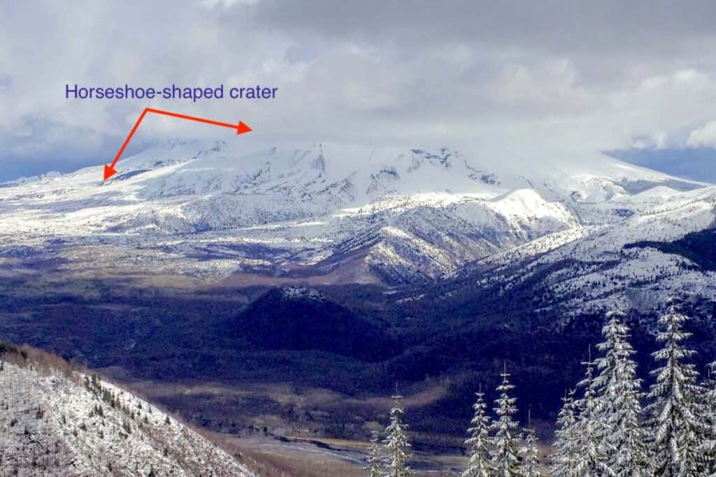
As a result of the eruption, fifty-seven lives were lost, forests were flattened, and the mountain was permanently altered. What had once been a nearly 10,000-foot peak became a wide, horseshoe-shaped crater with a jagged profile that still feels unsettling to look at. The mountain peak was now 8,366-feet tall.
A Shore Excursion with a Steep Price in Nerves
I visited Mount St. Helens as part of a Columbia River cruise with American Cruise Lines. The itinerary ran one way between Vancouver, Washington and Clarkston, Idaho. On the second day, I signed up for this motor coach excursion to the volcano without giving much thought to the drive itself.
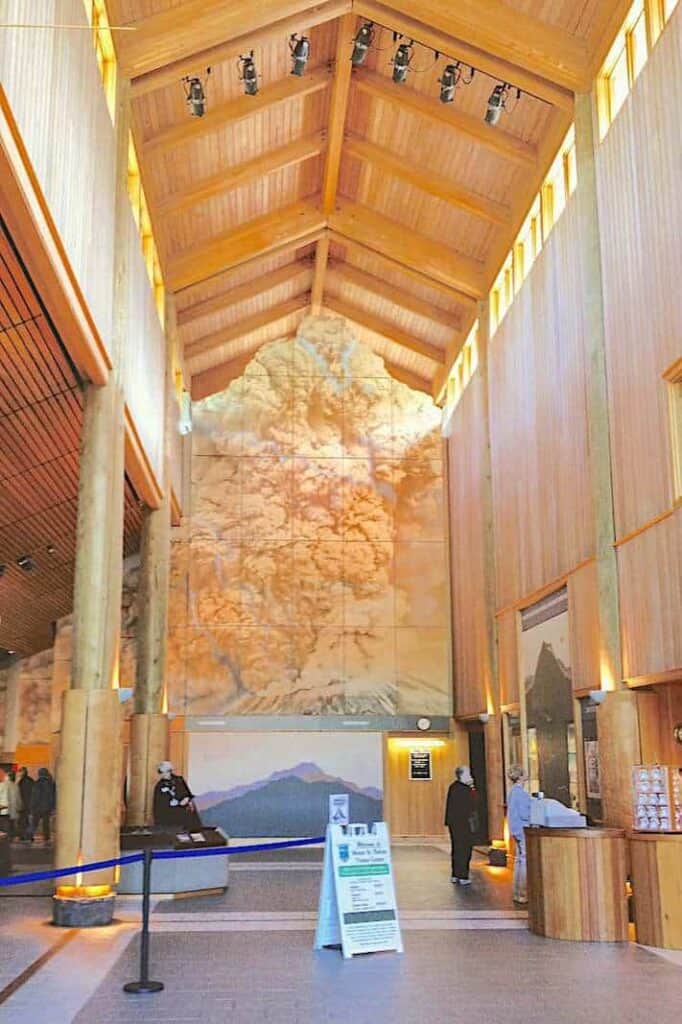
Our first stop was the Mount St. Helens Visitors Center, where a short film and exhibits helped frame what we were about to see.

Climbing the Mountain by Bus
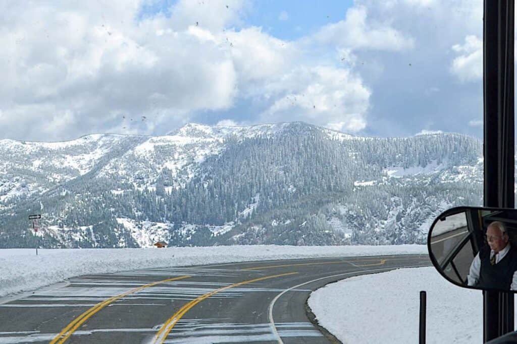
Back on the road, our driver explained that heavy snow had closed portions of the highway. We would not be able to reach the viewpoints closest to the crater. He would go as far as conditions allowed and find a safe place to stop.
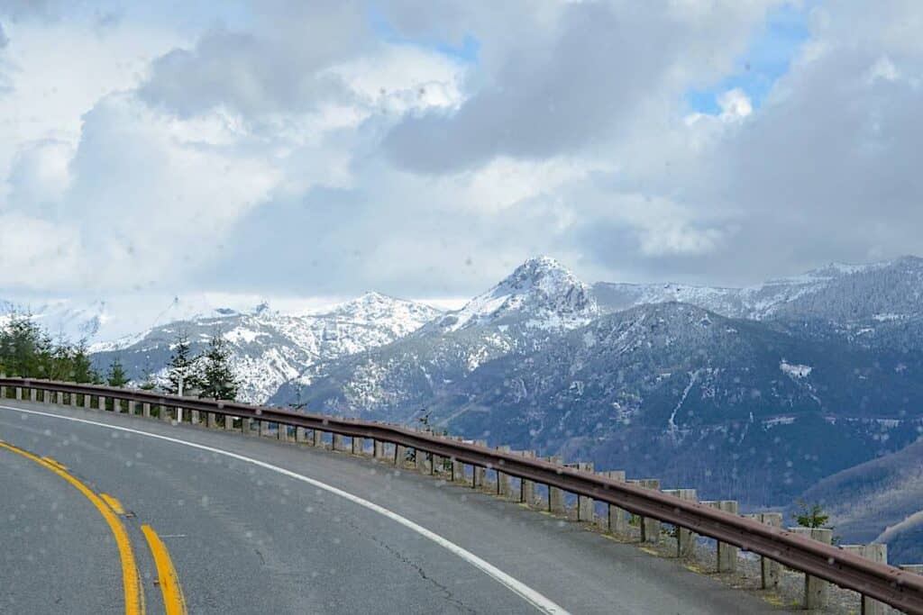
The road narrowed as we climbed. The turns tightened. The drop beside us grew deeper with every mile. I am much calmer when I am behind the wheel on my own slow travel trips! Sitting high in a large coach while it hugged hairpin curves was another story entirely.
I did what I always do when my nerves start to fray. I reached for my camera. Snow streaked past the tinted windows, and the light shifted constantly, but focusing on the view helped to take my mind off of the steep drops.
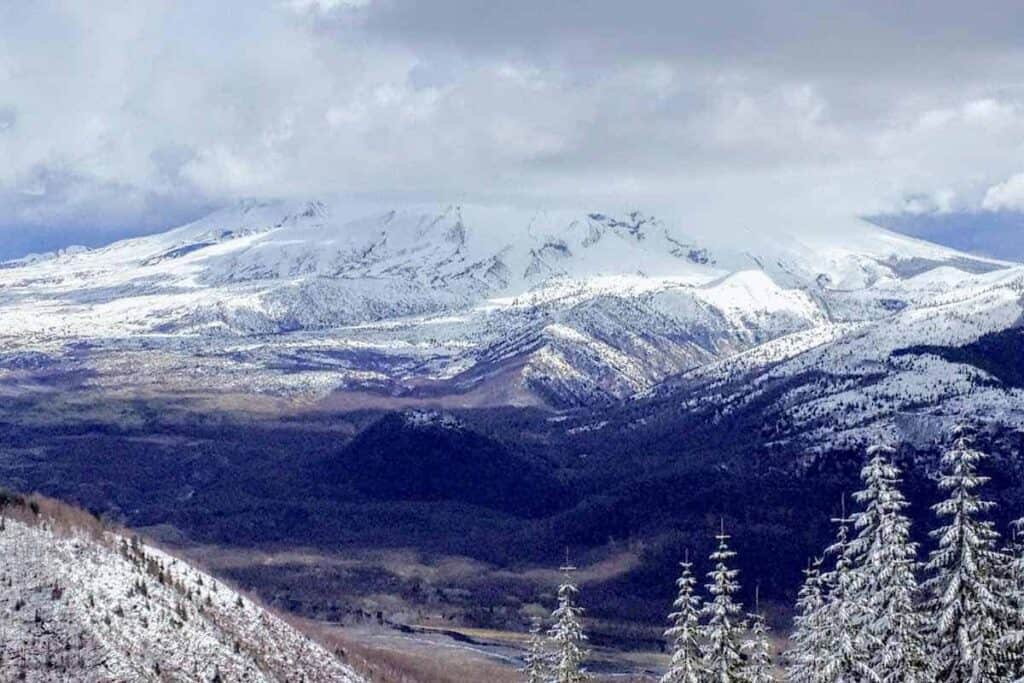
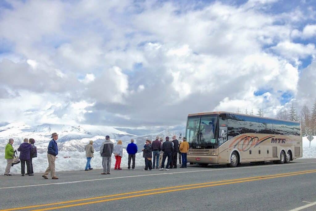
The tour bus eventually pulled off near Elk Rock Viewpoint. Snowbanks erased any clear sense of where the pavement ended and the overlook began. What mattered was the view.
The crater was visible but only after it was pointed out. The side of the mountain looked like a giant scoop had swooped in and grabbed a chunk of it.
Where I stood, the snow bank was so deep that I couldn’t tell where it was safe to step. So I remained on the side of the road with the rest of the group.
I could trace the road winding toward Johnston Ridge Observatory. That final stretch leads directly to the heart of the blast zone. We were close, but not close enough.
As Far as the Road Would Allow
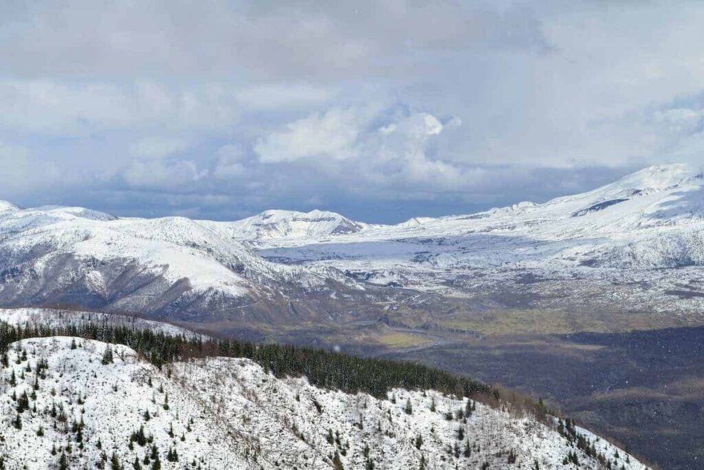
The bus traveled somewhere along State Route 504 at more than four thousand feet above sea level. It struck me how quickly we had climbed from river level to alpine terrain. Snow filled the landscape. The air felt sharper. The mountain loomed ahead, as if daring anyone to forget what it had done.
Just while standing there in the bright sunlight, the weather suddenly turned. Sunlight gave way to wind as clouds quickly formed. Then the snow squalls rolled in fast.
After about twenty minutes, the bus driver said told everyone to get back on the bus. I was grateful to get out of the wind but less grateful for what came next.
Turning Around on a Mountain Highway
The driver had to turn the bus around on the same narrow road that we took on the way up. He maneuvered carefully, executing a three-point turn with calm confidence.
While he was doing this, I kept looking out the back window as the bus moved nearer and nearer to edge of the snow-covered road. I hoped there was enough room! The driver had probably done this maneuver a hundred times. Nevertheless, it was a white-knuckled ride for me.
Snow swept across the pavement on the descent. The sky shifted from patches of blue to solid purple-gray. By the time we reached lower elevations, sleet streaked across the windshield. Not long after, we were back at the river, where the sun seemed unaware of the drama happening above.

The Mountain I Won’t Forget
Learning about the massive eruption through exhibits and films is one thing. Standing there, even at a distance, is something else entirely. The scale of the destruction was difficult to process until I saw the mountain in person. The loss of life, human and animal, becomes more than a statistic.
Mount St. Helens is not alone along the Columbia River corridor. As the cruise continues east, other volcanic peaks come into view, including Mount Hood and Mount Adams. The region is shaped by forces that are still very much alive beneath the surface. Its nickname is Volcano Alley.
United States Geological Survey monitors many of these volcanoes. Others are not. That fact lingered with me longer than I expected.
Someday, I would like to return when the roads are clear and the weather is calm. I’d really like to drive all the way to the end to the Johnston Ridge Observatory and look directly into the crater. Until then, the memory of that narrow snowy road, the sharp switchbacks and the mountain beyond it is more than enough to think about.